TURTLE LAKE SHORELAND: Site Portfolio
Site elevation: 1-foot contour intervals
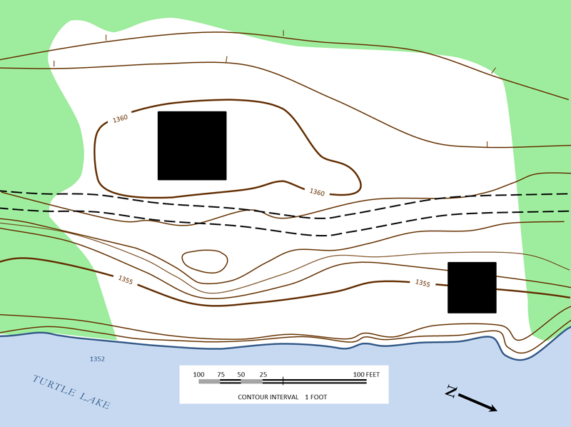
This topographic map was drawn during a site assessment. Note that the dark brown contour lines represent a 1-foot change in elevation with the elevation increasing as you move away from the lakeshore and decreasing again on the western side of the property.